Large-Eddy Simulation #262: (Lagrangian over water)
LES RUN #262: Periodic domain entirely over water started from
the 30-minute solution to #252. The purpose of this simulation
was to compare the turbulence statistics as a function of time
with those from #260 as a function of offshore distance to test
the hypothesis that the temporal evolution of the IBL is equivalent
to the spatial evolution.
200 x 120 x 69 with 15-m resolution in all 3 directions.
Arakawa & Lamb advection routine, VDKR=HDKR=0.05.
Click here
to see the NMSTASK file of LES #262.
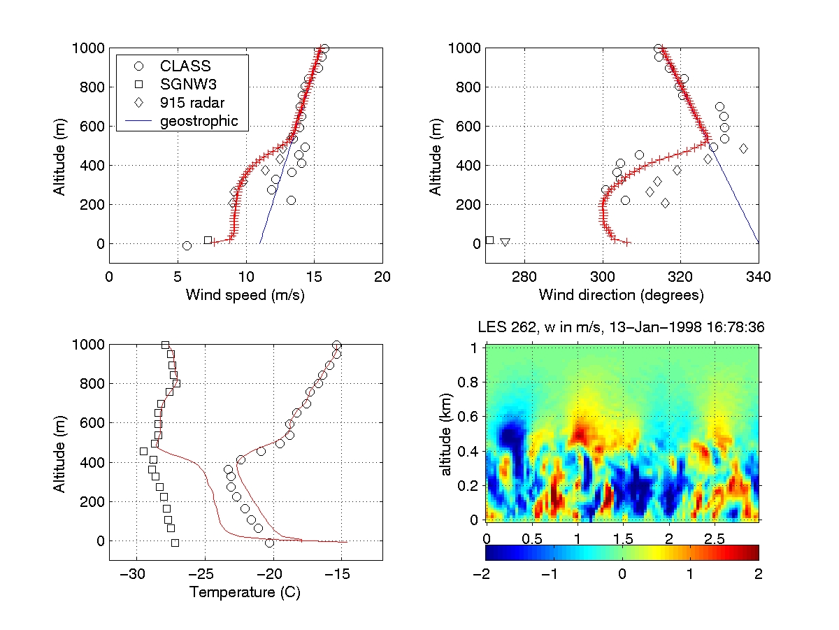
The following animation shows the
evolution of mean profiles (red lines) of wind speed, direction,
temperature and dewpoint as well as vertical velocity
on a east-west oriented vertical slice.


The following animation shows vertical velocity on 4 horizontal
slices: 7.5, 97.5, 202.5 and 397.5 m above the surface.

The following animation shows simulated lidar aerosol backscatter
at 7.5 m above the surface.

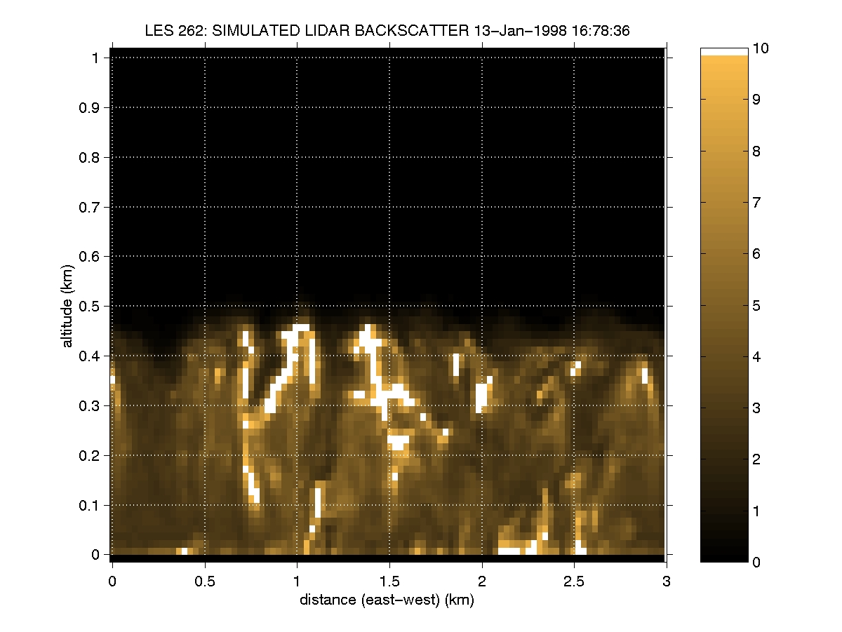
The following animation shows simulated lidar aerosol backscatter
on an east-west vertical slice through the model domain.

UW Lidar // Jan, 2001 // root@lidar.ssec.wisc.edu
Return to the
 Index
Index