Large-Eddy Simulation #212: (IBL)
LES RUN #212: This is a continuation of LES#210 (not shown) which
was the first simulation with a building installed on the shoreline.
LES#210 was a continuation of #208.
Click here to see the NMSTASK file of LES #212.
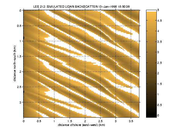
The following is a horizontal slice through the bottom of the model domain
(7.5 m above the surface) over the water only. The output has been folded over once in the
north-south direction to help your eye follow coherent structures across
the domain. This is an east-west subset of the model domain.

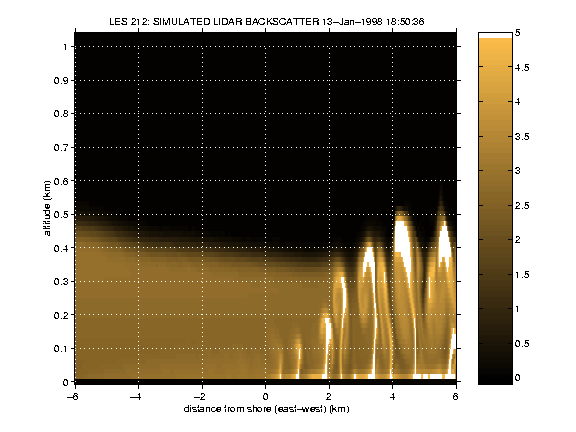
The following is an east-west vertical slice through the model domain.

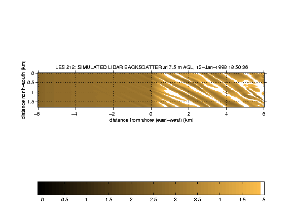
The following is a horizontal slice through the bottom of the model.
The entire area is shown.

The following movie shows the formation of the average simulated lidar
backscatter field as a function of time.

UW Lidar // Oct 2, 2000 // root@lidar.ssec.wisc.edu
Return to the
 Index
Index