Large-Eddy Simulation #197: (IBL)
LES RUN #197: This was the first attempt to simulate the
TIBL on 10 January 1998. This day differs from 13 January 1998
in that the surface flow is from the WSW (13 Jan was from the NW)
and the mixed-layer is 1-km deep (13 Jan was 400-m deep).
In order to simulate the deeper mixed-layer without increasing the
number of grid-points, the model resolution was changed
from 15-m to 30-m in all three dimensions. This made the
domain 2-km tall, 24-km long, and 3.6 km wide.
Click here
to see the NMSTASK file of LES #195.
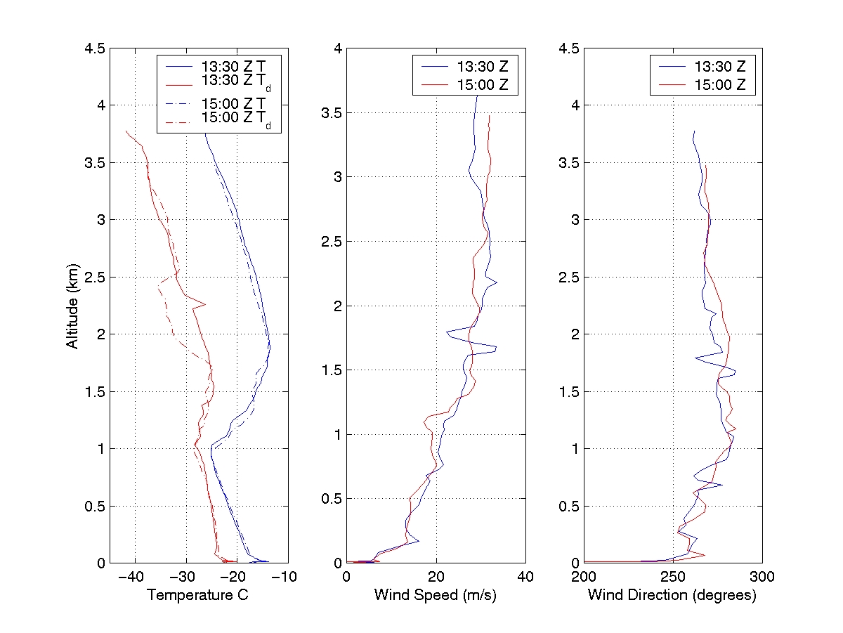
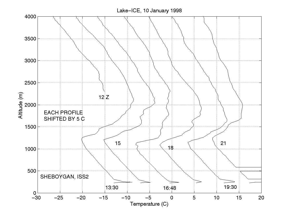
The following JPEGs show the soundings from the ISS2 on 10-Jan-98.
The sounding from 13:30 GMT was used to initialize the model.


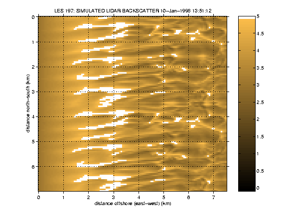
The following is a horizontal slice through the bottom of the
model domain (15 m above the surface) over the water only.
The output has been folded over once in the
north-south direction to help your eye follow coherent structures
across the domain. This is an east-west subset of the model domain.
The entire domain spans from 12-km west of the shore to 12-km
east of the shore.


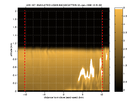
The following is an east-west vertical slice through the model domain.
The entire east-west span of the domain is shown.

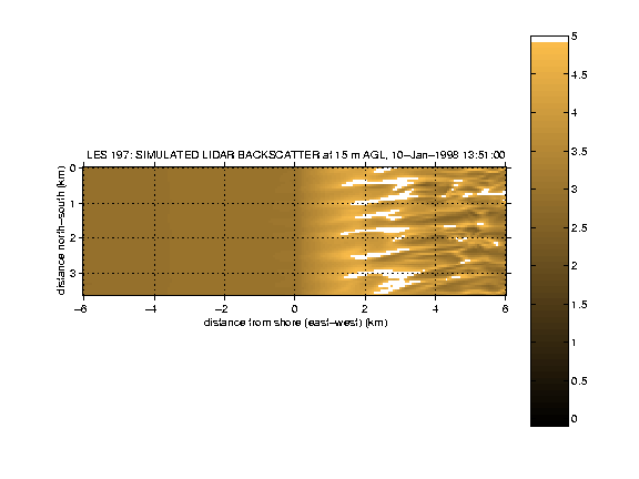
The following is a horizontal slice through the bottom of the model
from 6-km west of the shore to 6-km east of the shore. It has
not been replicated in the north-south. Purpose of this image
is for comparison with images from LES#181 and #195.

UW Lidar // July 18, 2000 // root@lidar.ssec.wisc.edu
Return to the
 Index
Index