Large-Eddy Simulation #190: (Upwind PBL)
LES RUN #190: Upwind shear & heat driven PBL over snow-covered land.
The simulation was initialized horizontally homogeneous according
to a radiosonde sounding 10-km west of the lidar site during Lake-ICE.
The domain is 200x120x69 grid-points with 15-m resolution in
all directions and 0.5 s time-step was used. The domain is
entirely over land and it has the same north-south dimension as
our largest TIBL runs (like #181). The grid is stationary and periodic in
the lateral directions.
Click here
to see the NMSTASK file.
The flow is from the NW with a 400 m deep mixed layer. The animations
shown are for about 3-hour simulations with over 600 frames each.
These are the longest animations we've made and were created using Matlab.
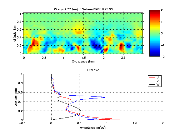
The following is a vertical slice through the model domain and
vertical profiles of the horizontal and vertical velocity components.

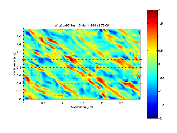
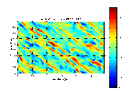
The following is a horizontal slice through the model domain at 67.5 m above
the surface.
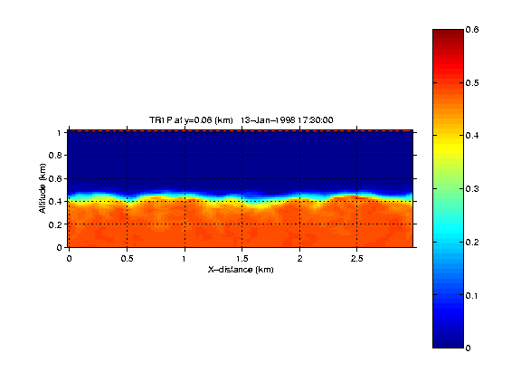
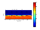
The following is a vertical slice of the passive tracer through the model domain for the
first hour of simulation.
the surface.
UW Lidar // Apr 18, 2000 // root@lidar.ssec.wisc.edu
Return to the
 Index
Index