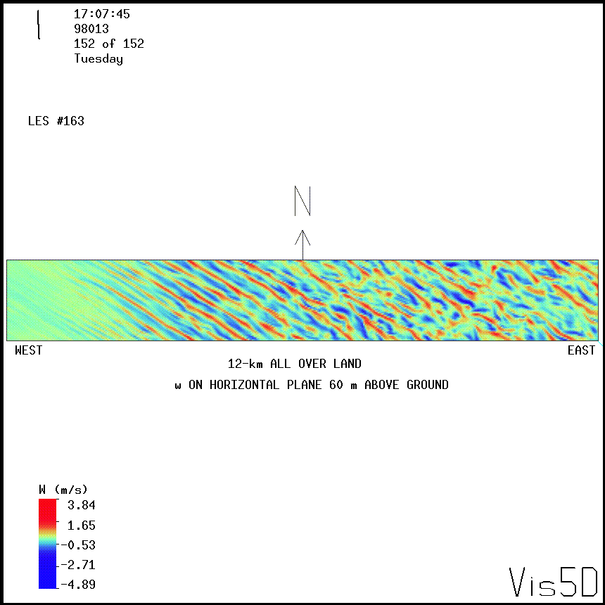
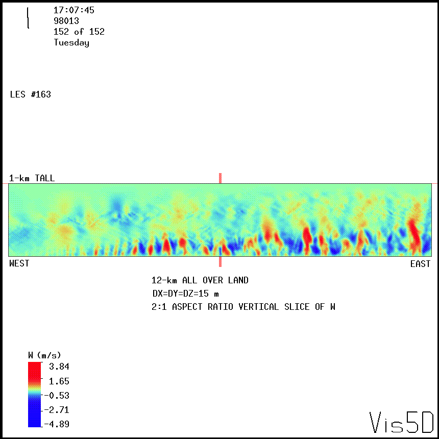
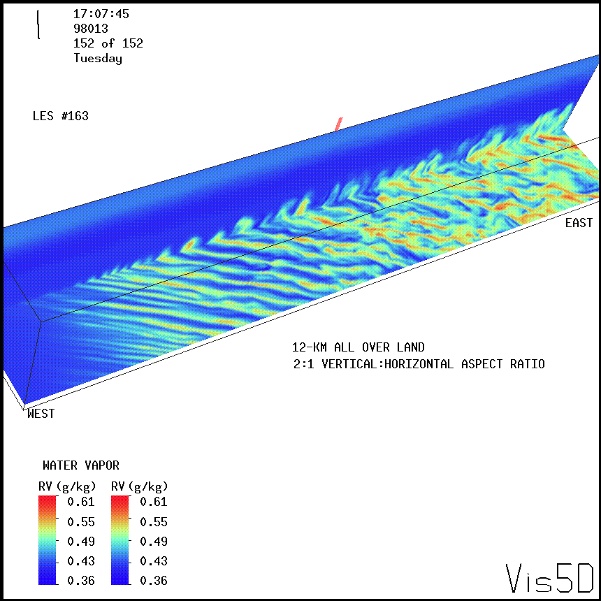
Large-Eddy Simulation #163: Land boundary layer
LES RUN #163: Land boundary layer.
This simulation is exactly the same as LES #149 except the entire
12-km long domain is over land. The purpose was to see how the ML we generate
over land grows (previously we only grew it over 6-km) and how the
coherent structures from 6-12 km look in it.
Click here to see
the NMSTASK file .
This domain is 12 km (east-west) by 1.650 km (north-south) wide by 1.0 km
tall. The horizontal and vertical resolution is 15 m in all directions.
The flow is from the NW with a 400 m deep mixed layer. The animations
shown are for a simulation that is about 37-minutes long (frames are every
15-s).
The west wall of this domain is perturbed by adding a random number
between + and - 0.5 cm/s to the v-component of flow for the bottom
3 grid-points 34-gridpoints east of the west wall.
This is done to speed the development of a shear-driven
mixed layer over the land before the air advects over the water.


UW Lidar // Jan 4, 2000 // root@lidar.ssec.wisc.edu
Return to the
 Index
Index