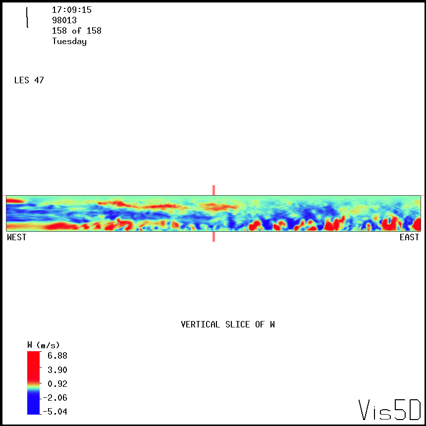
Large-Eddy Simulation #147: TIBL
LES RUN #147: TIBL.
This domain is 12 km (east-west) by 1.650 km (north-south) wide by 1.0 km
tall. The horizontal and vertical resolution is 15 m in all directions.
The left 6 km is over land and the right 6 km is over the lake.
The flow is from the NW with a 400 m deep mixed layer. The animations
shown are for a simulation that is 40-minutes long (frames are every
15-s).
The west wall of this domain is perturbed by adding a random number
between + and - 0.5 cm/s to the v-component of flow for the bottom
3 grid-points 34-gridpoints east of the west wall.
This is done to speed the development of a shear-driven
mixed layer over the land before the air advects over the water.
The western boundary of this domain is "floating" which is specified
by the variable INITIAL=1 in
the NMSTASK file . It appears, when
compared to LES #149, the this boundary condition causes east-west
oriented features in the flow-field that can be eliminated by using
the "fixed" boundary condition (INITIAL=3).


UW Lidar // Nov. 8, 1999 // root@lidar.ssec.wisc.edu
Return to the
 Index
Index