Large-Eddy Simulation #10
Return to the
 Index
Index
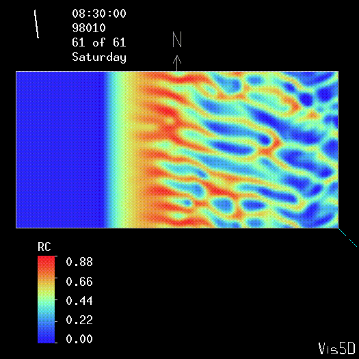
LES RUN #10: 50 m HORIZONTAL RESOLUTION
Click here to see the NMSTASK file that was used for this run.
This domain is 7 km (east-west) by 3.75 km (north-south) wide.
Top view of the condensed water field (in g/kg) at 1 m above the surface.


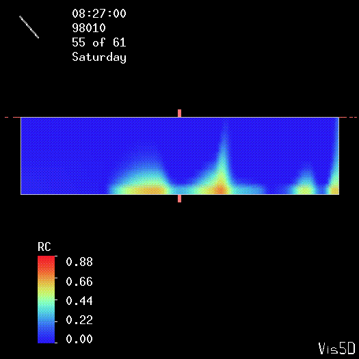
Side view of the condensed water field (in g/kg). This
slice is of the lower 10 grid points (1 - 16 m above the surface).
The volume imaging lidar observations confirm that the steam
fog is very shallow.

UW Lidar // April 20, 1998 // root@lidar.ssec.wisc.edu