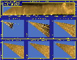
January 13, 1998 Observations
SGNW3 Hourly Surface Meteorological Observations for
13 January 1998.
SGNW3 10-minute anemometer winds for
13 January 1998.
Satellite imagery for
13 January 1998.
 Click here for Preliminary Large-Eddy Simulation Results
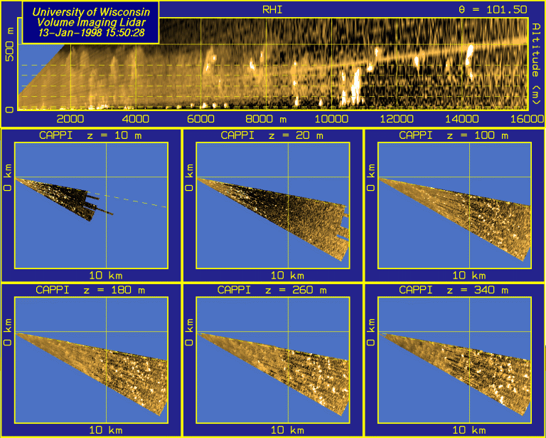
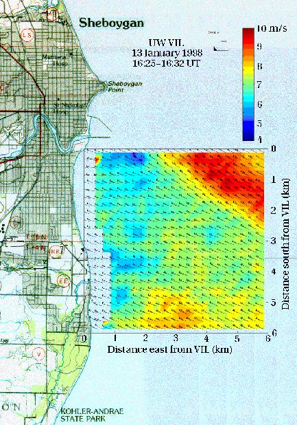
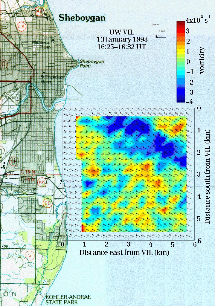
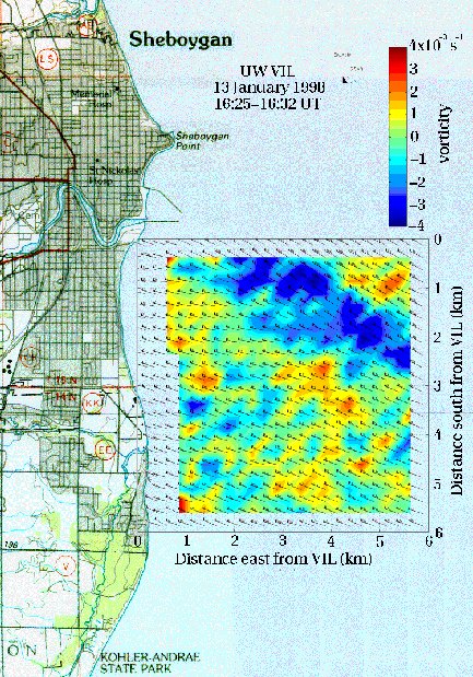
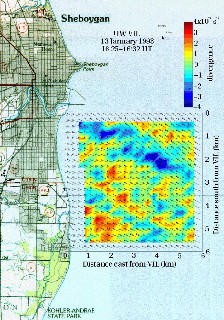
Here are fields of wind velocity, vorticity, and divergence for the
period 16:25-16:32 UTC calculated from cross-correlations of VIL backscatter data.
These fields were then added to a map of the Lake Michigan
shoreline at Sheboygan.
The VIL was located at the origin (Upper left-hand corner) of the axes.
Start of Data Session
RHI Volume scans from 12:48-13:36 UTC.


RHI Volume scans from 15:50-16:21 UTC.

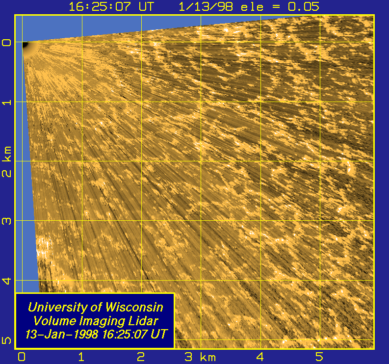
PPI scans from 16:25-16:30 UTC.
RHI Scans from 16:44-17:00 UTC.
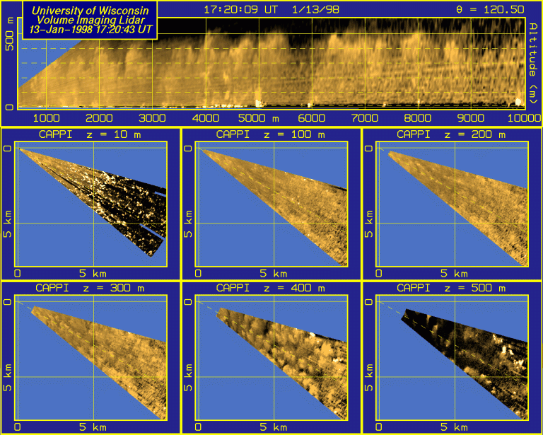
RHI Volume scans from 17:20-18:36 UTC.

End of Data Session
UW Lidar // April 20, 1998 // root@lidar.ssec.wisc.edu
 Calendar


